September 2017

TEMPERATURE

Geelong’s temperature was fractionally (0.05 degree C) below the latest 30-year average. Nights were 0.1 C cooler and the maximum daily temperatures were exactly equal to the average. Minimums averaged 7.1 C and maximums 17.1 C. The warmest day reached 23.2 C on the 21st, and 7 days exceeded 20 degrees C.

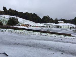
Snow fell on Sept 5th in the Otways  – see photo below courtesy Lisda Speight.

RAINFALL

Most of the region received above to well above average rainfall, except for some areas to our north and northwest from Lara to the Rowsley Fault and some parts beyond. Rainfall totals varied from 14.2 mm at Werribee up to 312.4 near Beech Forest. Geelong Racecourse received 68.2 mm (30-year average 49.1 mm).

OTHER FEATURES

There was one frost on the 1st, 2 days of hail on the 4th & 5th, snow in the Otways from Lorne to Lavers Hill on the 5th, one thunder day on the 15th and 8 days of high wind gusts over 60 km/h. The strongest gust at Breakwater reached 93 km/h on the 4th.

RAINFALL DATA

GEELONG REGION
Location Total for
Month
(mm)
Monthly
Average
(mm)
Aireys Inlet 73.4 (71.9)
Anakie 39.0 (64.0)
Anglesea na (70.5)
Apollo Bay 223.2 (108.6)
Ballan 62.4 (51.5)
Ballarat 50.4 (73.0)
Bannockburn 30.0 (52.0)
Barwon Heads 52.8 (61.0)
Bellbrae 91.0 (60.5)
Bells Beach 60.8 (60.5)
Beeac 50.1 (59.9)
Beech Forest 312.4 (180.8)
Boonah 125.6 (n.a.)
Benwerrin 89.4 (n.a.)
Birregurra 100.0 (69.6)
Buninyong 81.4 (n.a.)
Clifton Springs 57.8 (65.0)
Cape Otway 151.2 (89.6)
Colac 176.8 (68.0)
Cressy na (n.a.)
Curlewis na (68.6)
Dereel 55.6 (68.6)
Durdidwarrah 103.8 (69.9)
Forrest na (106.5)
Forrest (West Barwon) 217.0 (118.0)
Gerangamete 124.0 (n.a.)
Inverleigh 73.0 (51.6)
Lorne 126.2 (102.2)
Lal Lal 73.0 (82.0)
Lavers Hill na (180.0)
Laverton 20.4 (53.0)
Melton 18.2 (n.a.)
Melbourne (City) 38.6 (59.4)
Meredith (Darra) 48.0 (70.4)
Moriac 88.3 (56.0)
Mt Gellibrand 102.4 (n.a.)
Mt Cowley 194.6 (n.a.)
Mt Mercer 61.6 (n.a.)
Mt Sabine 118.0 (n.a.)
Ocean Grove 54.0 (n.a.)
Point Lonsdale 53.7 (59.2)
Pollocksford 74.4 (n.a.)
Portarlington na (59.2)
Queenscliff na (59.2)
Shelford 54.8 (54.6)
Sheoaks 49.0 (n.a.)
Skipton 52.8 (n.a.)
St Leonards 76.5 (58.0)
Sutherlands Creek 30.2 (47.7)
Torquay na (58.0)
Warncoort 150.0 (n.a.)
Werribee 14.2 (51.0)
Winchelsea na (54.4)
You Yangs na (46.0)


GEELONG SUBURBS
Location Total for
Month
(mm)
Monthly
Average
(mm)
Avalon 23.6 (45.9)
Belmont 72.5 (50.2)
Bell Park 61.3 (50.0)
Breakwater 68.2 (48.0)
Connewarre 85.2 (60.3)
Corio 46.0 (46.6)
Drumcondra 86.4 (46.6)
East Geelong na (46.6)
Grovedale 86.8 (51.0)
Grovedale South 85.8 (51.0)
Hamlyn Heights 63.9 (51.9)
Herne Hill 63.0 (51.9)
Highton 66.8 (51.8)
Lara 26.2 (47.5)
Lara (Serendip) na (47.5)
Leopold 65.0 (50.8)
Leopold East 63.7 (50.8)
Manifold Heights 64.5 (51.9)
Moolap 65.4 (52.0)
Queens Park 53.8 (52.0)
Waurn Ponds na (49.7)
Whittington 61.6 (50.3)
Urban Area Average 60.0 (49.7)